
How to prepare for a day hike without misjudging the effort
Elevation gain matters more than distance, and mountain weather reads differently from town weather. Here is how I prepare for a hike, in five points.

Sports
Summit Journal
Summit Journal is a hiking journal app for iPhone that records your GPS track, pins your photos onto the map and keeps every trail you have ever walked.
Free and complete. Summit Pro is €2.99 a month or €24.99 a year, with a seven day trial.
GPX
import, follow and export your tracks
3D
cinematic flyover of your route
No ads
no advertising, no forced account
01 Where it started
Nowhere. That is where they ended up. A GPS track in an app that gave me a distance and a calorie count, two hundred photos drowning in the camera roll, and six months later no way of telling whether that summit was June or September.
What was missing was not another metric. It was the story of the day: the weather, the state of my legs at the top, the fact that the path was soaked and we took the wrong turn at the second junction.
Existing hiking apps do the sport part very well. None of them did the memory part. So I wrote the one I was missing.
I wanted a hiking notebook, not a calorie counter.
02 On the trail
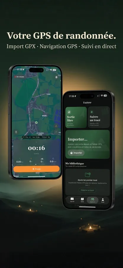
You start recording at the car park, put the phone back in your pocket and walk. Summit Journal logs the track, the altitude and the time without you having to think about it.
If you are following a route you prepared in advance, you import your GPX file and the app guides you along it, announcing turns out loud. And since the mountains are the place where signal disappears fastest, all of this keeps working offline.
03 The journal
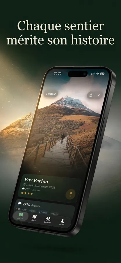
Back at the car, you open the entry for the hike. The date, the weather and the track are already filled in. All that is left is what only a person can add.
A summit photo, two lines on the state of the path, a rating out of five. Five minutes of writing while the memory is intact beats an hour of reconstruction in January.
The part a machine can do, it does. The rest is you.
04 Photos
This is the feature I show first when someone asks what the app is for. Your photos are not in a separate album: they sit on the map, exactly where you pressed the shutter.
You follow the track with your finger and the day replays itself. The stretch through the woods, the break by the water, the view opening up all at once. A camera roll cannot tell that story. A map can.

05 Hike detail
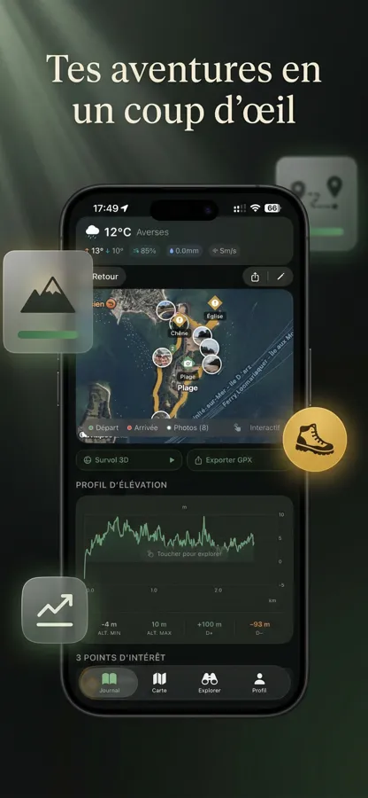
Every hike gets its full page: elevation profile, minimum and maximum altitude, total ascent and descent, points of interest along the way.
You can also replay the route as a 3D flyover, which is the most effective way I have found to explain a climb to somebody who was not there.
06 The year
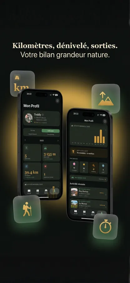
At the end of the year the app sums it all up: number of outings, kilometres, total elevation gain, busiest month, split by season.
It is the most satisfying moment of the year, and it is also the one that makes you want to head back out. Seeing your yearly ascent add up to a famous mountain pass does something to you.
07 Explore
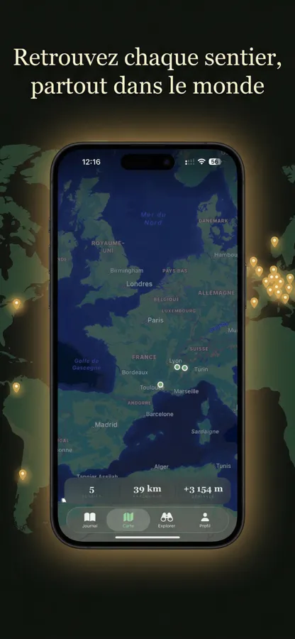
Every outing lands on a world map. You see at a glance where you have walked, and you can find a three year old track without remembering its name.
To prepare the next one, import as many GPX files as you like into your library and keep them ready for the day.
Distance, duration, altitude and pace recorded while you walk, with no mobile signal required.
Load a route you prepared in advance and follow it, with spoken turn announcements.
Photos, free notes, a rating out of five and the weather of the day attached to every outing.
Each shot appears exactly where you took it, along the track.
Replay the route from above and read the climb without decoding an unreadable chart.
No forced account, no advertising, no selling your tracks to anybody.
Sharing outings with friends is the current build. The point is not to add one more social network, but to be able to send a complete hike, photos included, to the person you walked it with.
If you use Summit Journal and a track behaves oddly, send me the GPX file. Looking at real cases is how I fix the situations I had not anticipated, and the mountains produce plenty.
Tap Free session at the trailhead and the app records the track, the distance, the altitude and the duration until you stop. By the time you are back, the outing already exists in your journal with its map and its weather.
Yes. GPS tracking depends on satellites, not on the mobile network. You can record a full hike in a dead zone, and everything syncs once you are back in coverage.
Yes, as many as you like. Add your files to the library, keep them ready, and follow them on the day of the hike.
No. Your outings, photos and notes are stored on your iPhone. No account is required to use the app.
Detailed weather for every outing, the cinematic 3D flyover, an unlimited GPX library and advanced statistics. It costs €2.99 a month or €24.99 a year, with a seven day trial.
Summit Journal requires iOS 18 or later.
Download
Summit Journal is on the App Store.